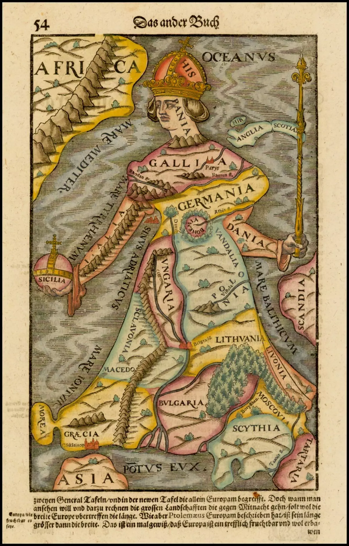
Five hundred years ago, when a person just began to explore the world outside Europe, the inaccuracy of the cards was compensated by the beauty of the design. The boundaries were conditional, but drawings on the fields are great. Mermaids floated in the Pacific Ocean, camels grazed in Siberia, and Europe was depicted by the Queen, in the heart of which - Bohemia, and somewhere at the knee level - Moscow. So the world looked to Columbus. 1493, Admiral has not returned to Spain yet, and therefore there is no Western way to India on the map. There is Arabia, India, something like China, Africa, Ural Mountains and some very kutsaya Europe. Keep the map of the puff, Sim and Ham, and on the fields - the mythical peoples, the legless centaurs and other multi-eyed monsters. For some reason, the pupils are not. But the beginning of the 16th century. Columbus and his followers returned with detailed outlines of the island of Espanyola (Cuba) and the Eastern Coast of America (however, and the words did not come up with this then). Favorite reception of antiquity cartographers - to portray the world as an allegory. Asia is Pegasus. China is a tail. Istanbul - Konskaya Nostril. Northern India and Pakistan - you know what.
In fact, the cards in the form of living beings were drawn not from ignorance. Fully investigated Europe can also be depicted as a queen. Spain - Corona (the most powerful power of the 16th - early 17th century, so that all this is not good, Muscovy somewhere in the legs, wonderful bohemia (the current Czech Republic) - or the heart, or the stomach).
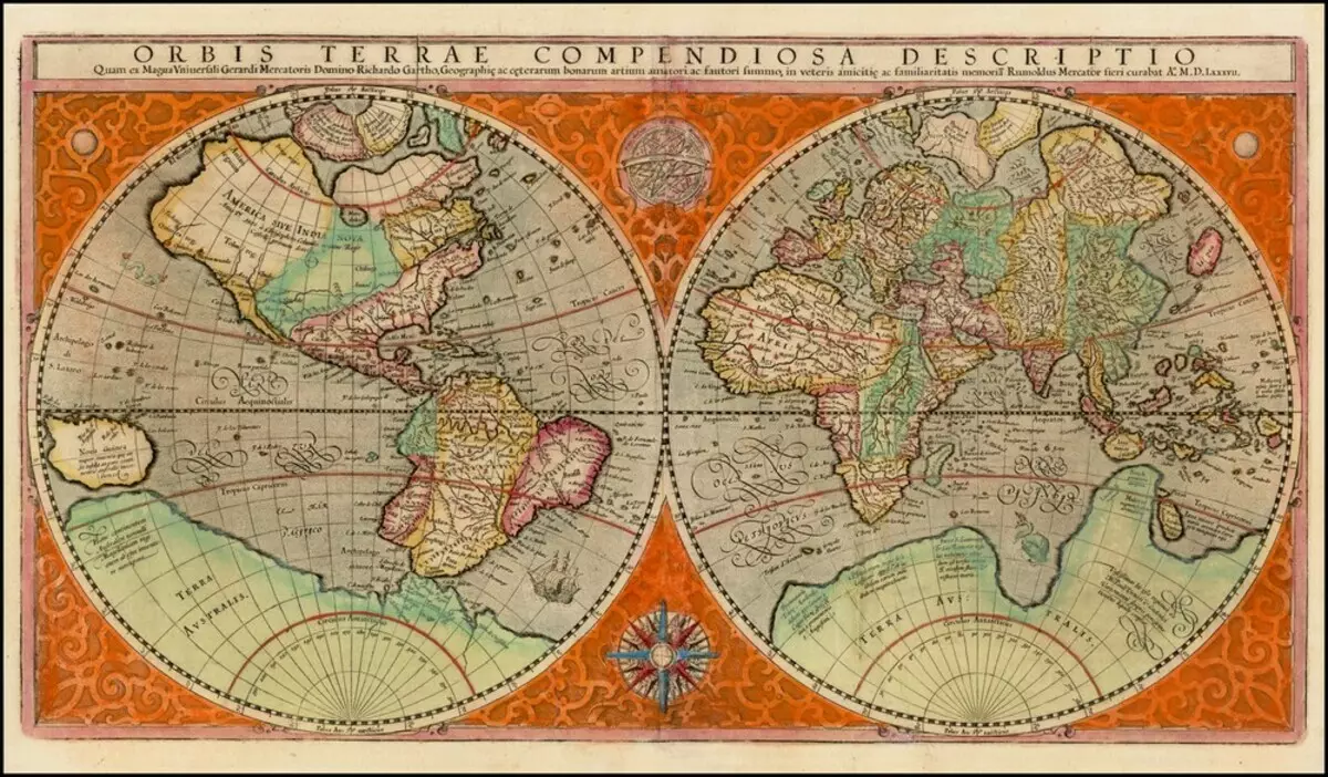
The number of knowledge increases, the cartography is developing, and the world takes almost modern outlines. This is the famous Orbis terrae, the globe of the Mercator, one of the inventors of modern cartography, a man who, in particular, gave the word "atlas" meaning - "Card Collection". White stain on the site of Antarctica, there is still no Australia, but the shores of the Mediterranean Sea are defined extremely. By the way, the Mediterranean Sea Europeans explored "from" and "to" back to prehistoric times, however, the cards with errors crossed almost two millennia, from the time of Ptolemy.
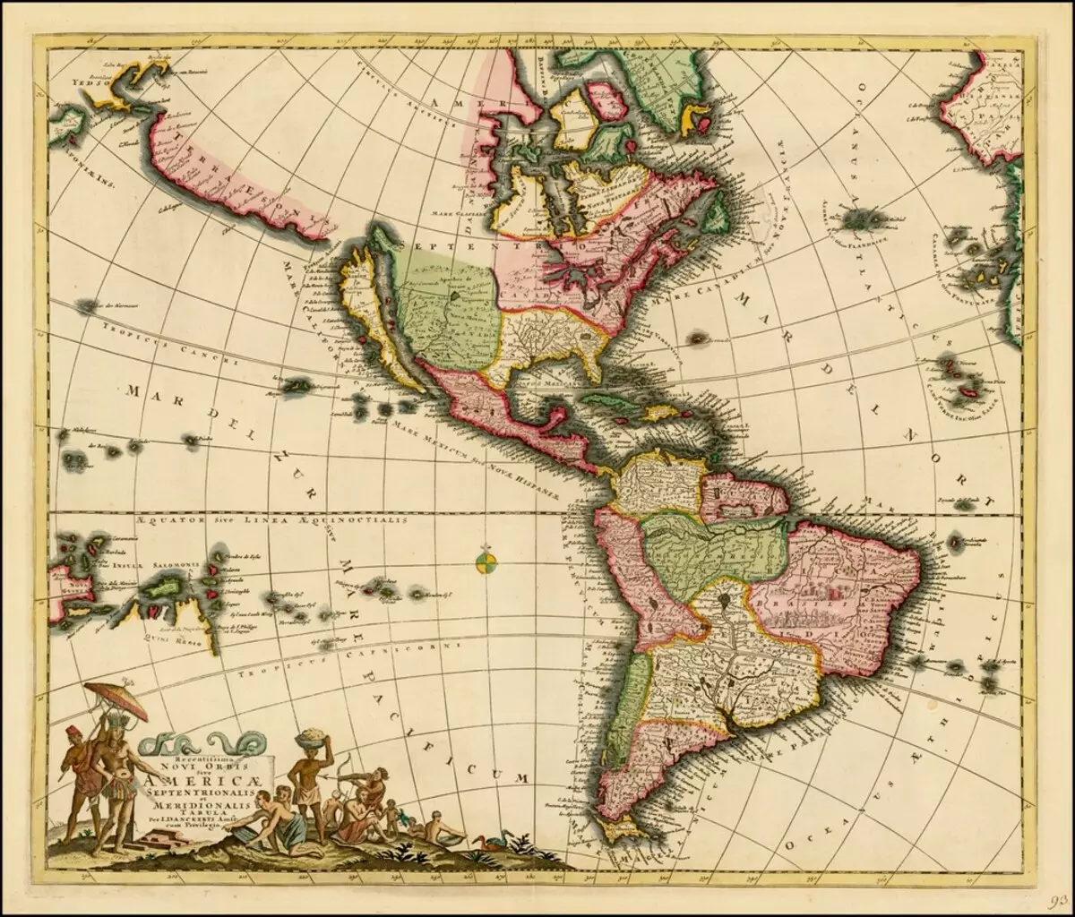
Map of America Nicolaus Visser 1658. A fairly accurate description of the Eastern Coast and the whole Spanish South America, but for some reason California is depicted in the form of the island. Sometimes you want to think about it: and not it would be more interesting to live in the world corresponding to these cards?
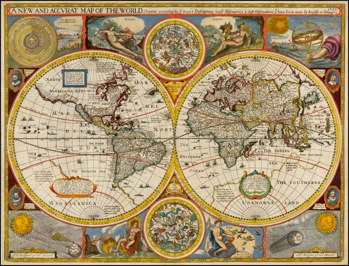
1651 year. The "new and accurate map of the world" practically repeats emerging almost a hundred years before the Mercator's card. Among other things, there are four elements, alchemical planets, signs of the zodiac and the Hand of the Lord, who keeps the solar system.
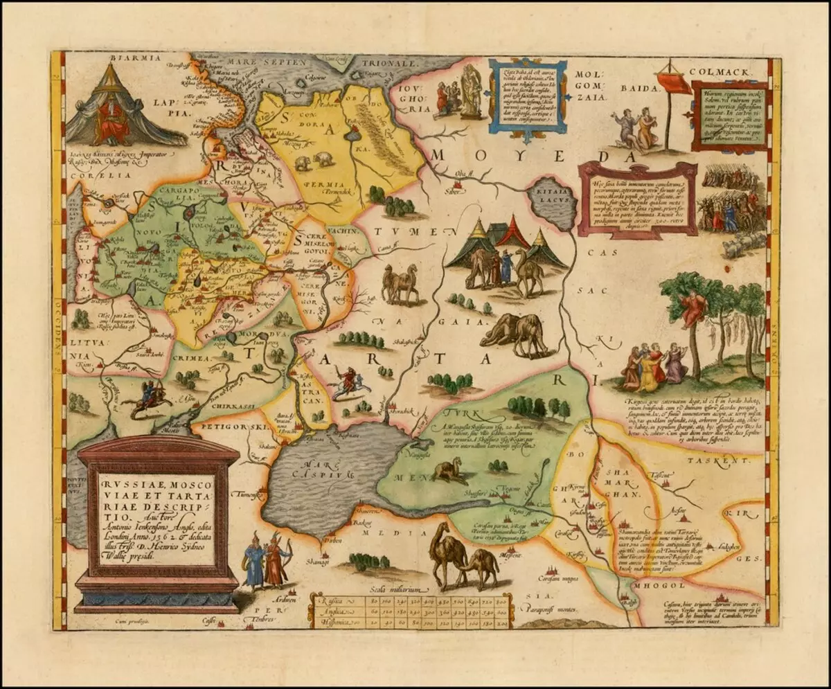
In fact, all these beautiful cards had more general education. Float and traveled through other atlases, much less large-scale and detailed. For example, on this map of Russia, Muscovy and Tartaria simply shown that somewhere the north of the Black and Caspian seas live Muscovites, which surround from all sides, wild tribes - Tartars, Samoyed, Markomazaya and Baida, as well as their camels. African one-stranded, by the way, and not our Asian dugorby baked bars. This is one of the maps of Abraham Orel, one of the greatest geographers, travelers and compilers of their time. Just about Russia, he knew a little more than about Australia.
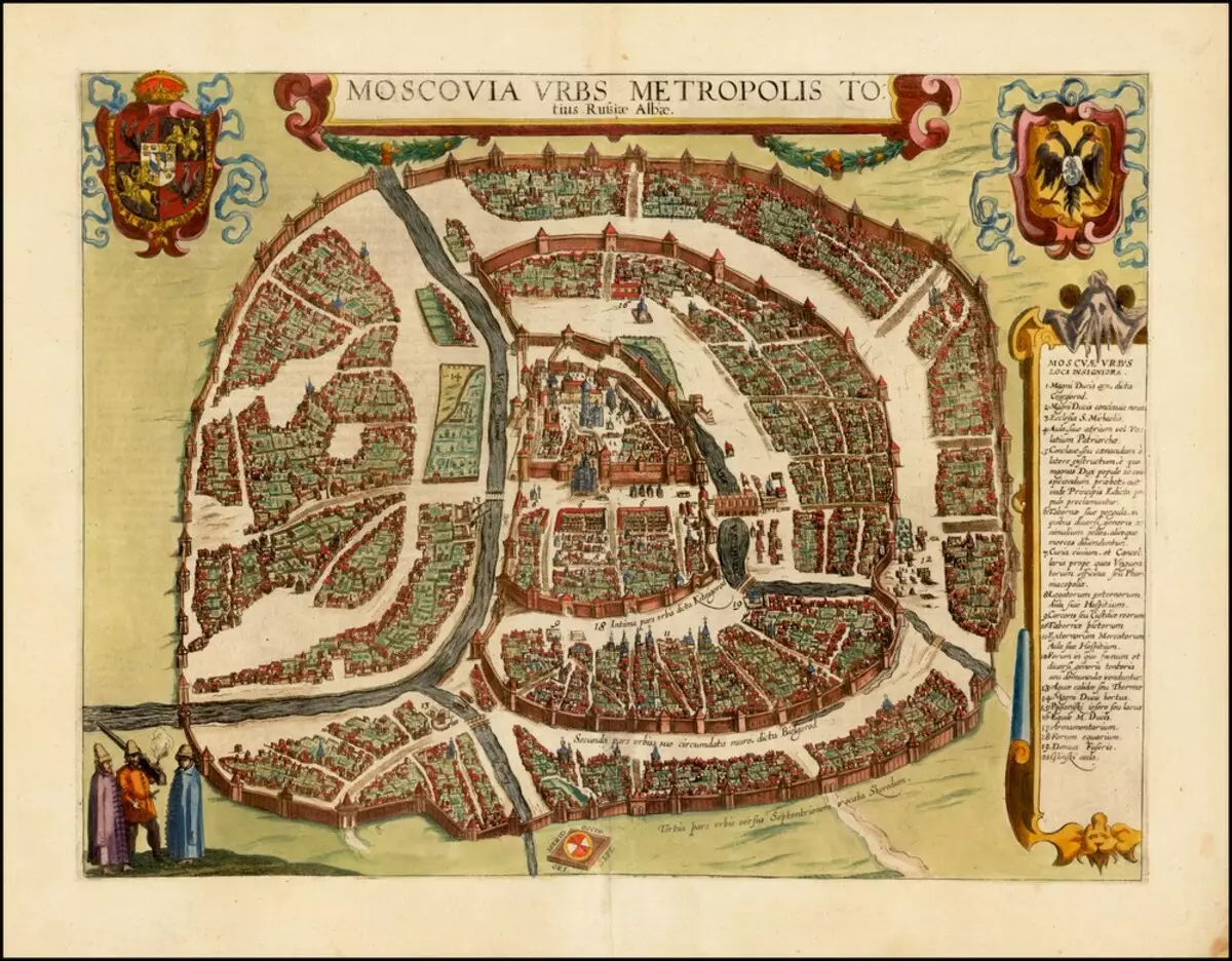
List from the Atlas of World Cities Civitates Orbis Terrarum Dutch Brown and Hokerberg. . The horizon is littered, north for some reason on the bottom-below, but not to know the city is impossible. In the center - the Kremlin, east of him - the wall of China-city, around - the belt of a white city (the current boulevard ring) and another ring of the walls - the current garden. A little confuses the river, enveling the Kremlin and flowing into Moscow. This is an unborn, she is samonek. The river was taken into the pipe at the beginning of the 19th century. But on this map it is clear that the Kuznetsky Bridge and in fact was once a bridge. Photo source: www.raremaps.com